Discovering the Bay
As enormous and glorious as San Francisco Bay is, it is an easy pace to miss. From the sea, the entrance of the Golden Gate is nearly invisible unless you know it is there, even when the fog isn’t obscuring everything. By land, the coastal range makes it remote. Until about 250 years ago, a few thousand native americans had the entire San Francisco bay area to themselves.
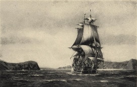
Sir Francis Drake missed the Golden Gate when he anchored south of Pt. Reyes, in what we now call Drake’s Bay. The first known non-native visitor was Don Caspar de Portola, who came overland from Monterey in 1769.
European settlement in San Francisco began when Captain Juan Agustin Bautista de Anza led a party up from Montery and chose Fort Point to build Mission Dolores in 1776. San Francisco was a Spanish territory from then until 1821, when it became part of newly independent Mexico.
Even after its discovery, San Francisco remained a remote outpost, reached from the east coast of America or from Europe only after a long passage around treacherous Cape Horn.
The Gold Rush
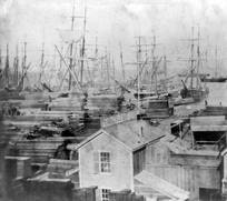
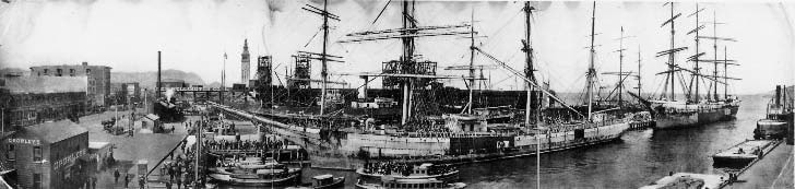
Everything changed for San Francisco when gold was discovered at Sutter’s Mill in 1848. In 1849, hundreds of thousands of people came to San Francisco on their way to the Sierra Nevada to find gold. In just a few months, San Francisco grew from a mission and a handful of houses into a city of hundreds of thousands of people, lined with wharves. The bay filled with hundreds of sailing ships, the vast majority of which were abandoned as the crew went looking for gold.
San Francisco grew very quickly into a rich and diverse city, fed by profits from the goal rush and, to an even greater degree, by all the businesses that served the community.
Earthquake and Fire
After almost 60 years of wild growth following the gold rush, San Francisco was devastated in just a few hours by the earthquake struck on April 18, 1906. The fire that followed did even more damage.